
Simultaneous with the 125th edition of Switzerland’s Statistical Yearbook, the FSO publishes Switzerland’s Graphical and Statistical Atlas 1897–2017. Many of the attractive illustrations from the early days of the Statistical Yearbook are faithfully reproduced in this volume. This is the latest FSO atlas, incorporating facsimiles of maps and graphs from the Statistical Yearbook of 1987, which was published as an atlas. It also contains graphs in table form from the yearbooks 1891 to 1899, and illustrations on the same topics compared with new figures from the year 2017. Alongside the yearbook, the atlas is able to provide immediate comparisons and an exciting visual journey through time, with facts on the social and spatial structures of Switzerland 125 years ago and today.
Prizewinner at the International Cartographic Conference 2019
Introduction
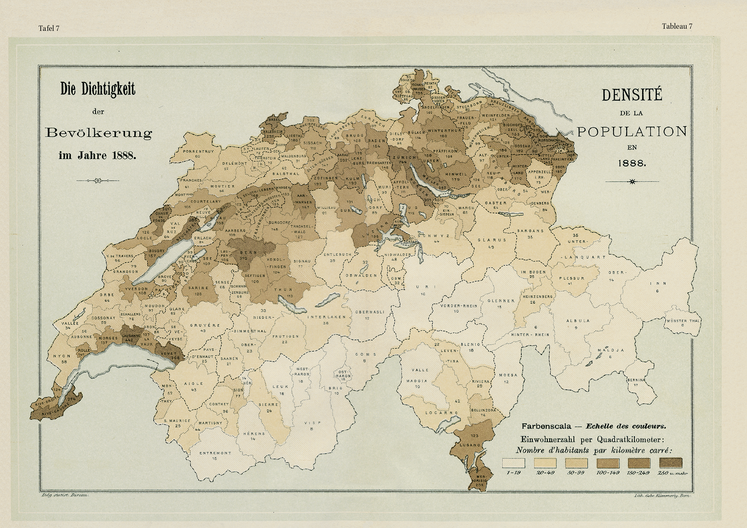
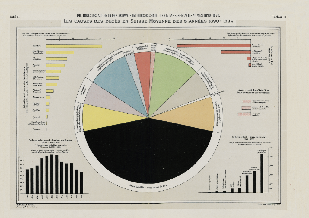
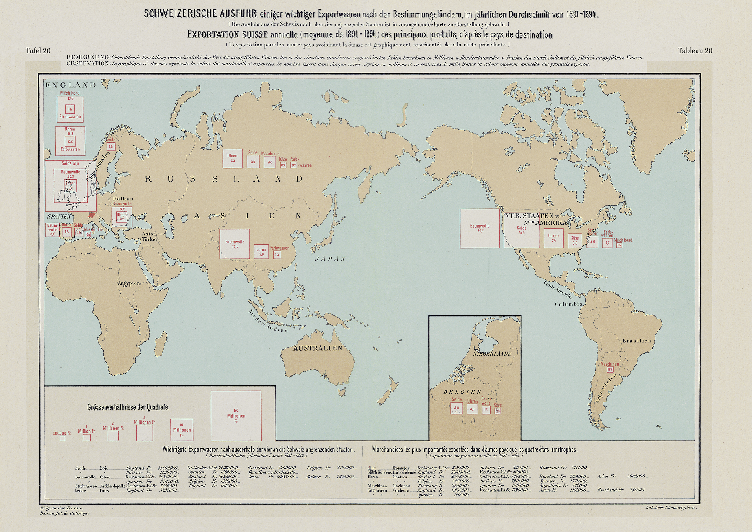
Maps and diagrams 1897


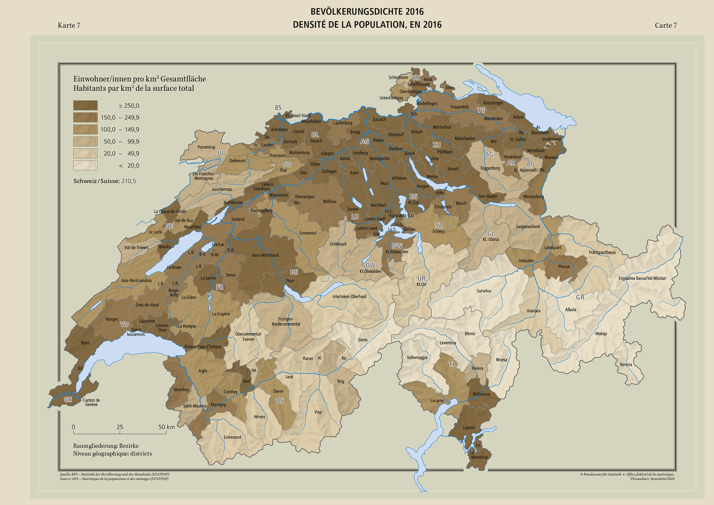
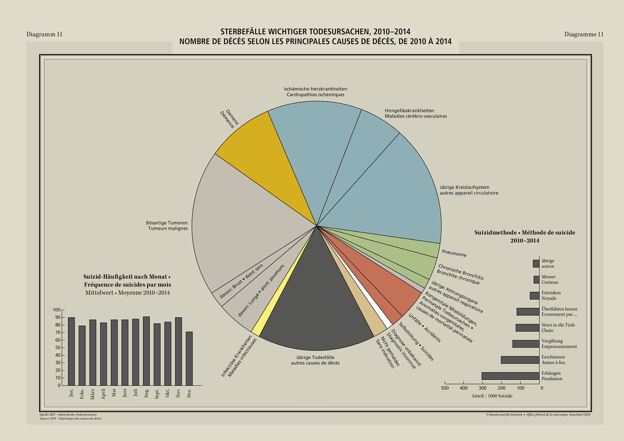
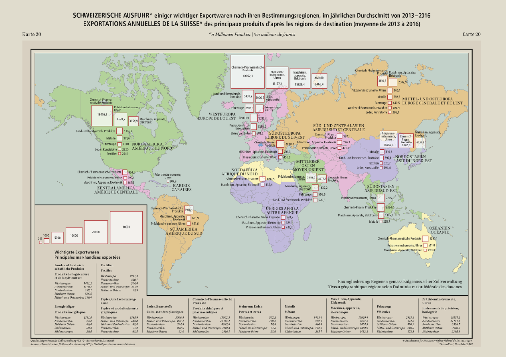
Maps and diagrams 2017


Content and format
Facsimiles of maps and graphs from the Statistical Yearbook of 1987, as graphs in table form from the yearbooks 1891 to 1899, and illustrations on the same topics are compared with new figures from the year 2017. 49 coloured maps and diagrams are presented over 64 pages. The hardback atlas has the format of 41cm x 27cm.
Orders
Associated documents

