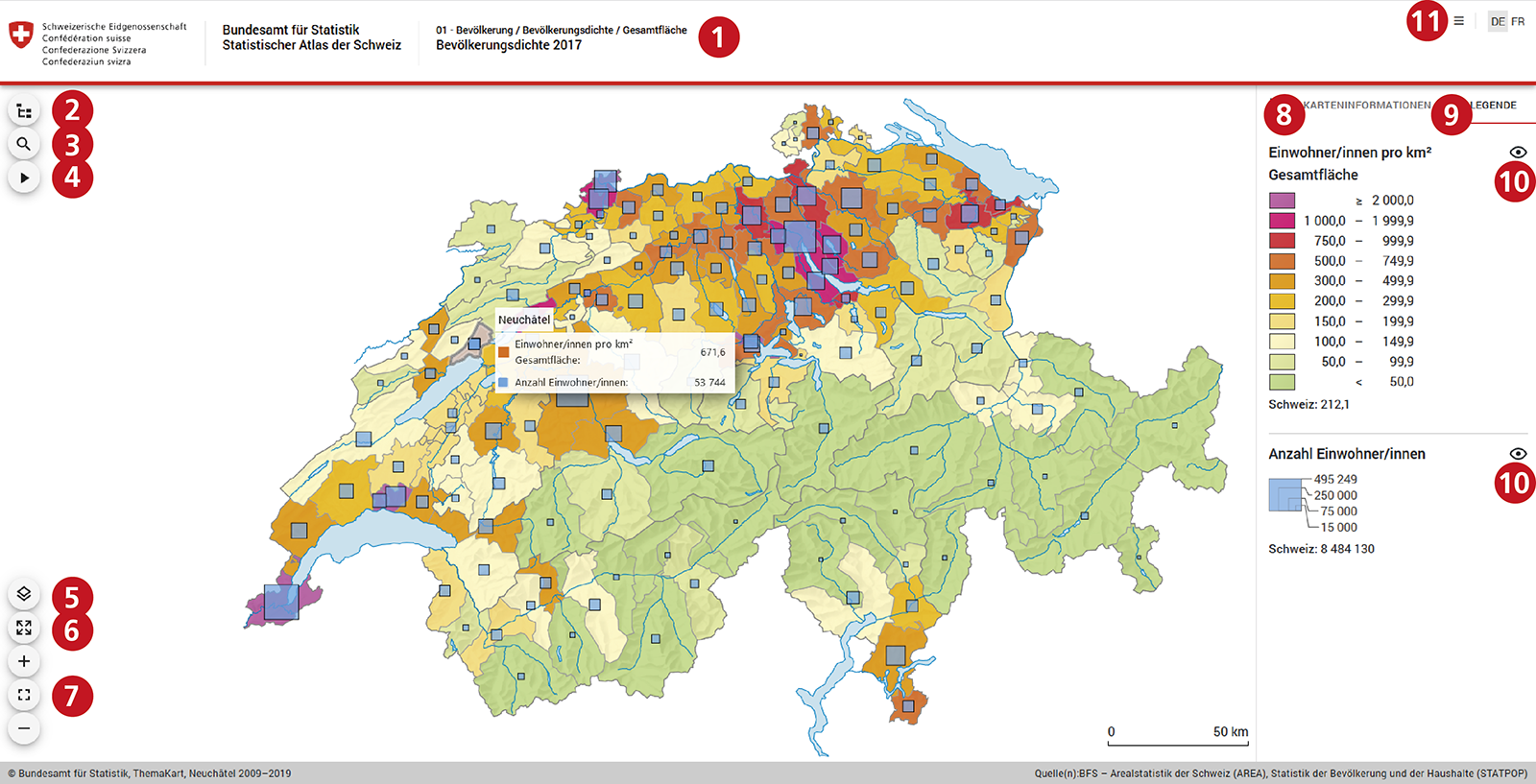
- Topic and map title
- Contents (navigation, divided into topics)
- Form (terms from the map title, name of a spatial area)
- Map animation (spatial/temporal developments)
- Show or hide map layer
- Enlarge map and explanation on full screen
- Change map scale (zoom)
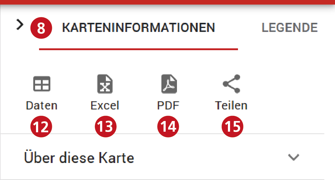
- Map information (fig. 2): About this map, definitions, calculations, sources, survey periods, geographical reference, etc.
- Map explanation
- Show and hide topic
- Languages, glossary, copyright, contact
- View and sort dataset, select spatial area (fig. 2)
- Download dataset
- Download map (vector data)
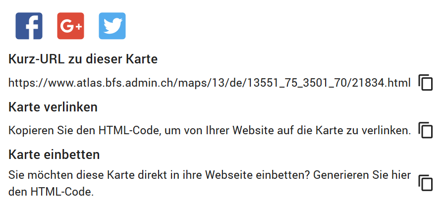
- Share map (HTML iFrame, HTML link, social media)
Overview: graphical user interface
Interactive exploration
A tooltip shows the name of the spatial unit and the visualised statistical values. When moving over a colour field in the explanation (9), all corresponding spatial units in the map are shown separately in graphic form. The statistical data can be shown in an interactive table (12) and sorted into a column by value. By selecting a spatial unit in the table, the map zooms directly into this spatial unit.
Reutilisation
The statistical data can be downloaded as a table (13) and the map as a PDF file (14). It is easy to share the map (15) on social media or on a website. With just one click, the short URL or the link element can be copied and pasted anywhere. The map application can be integrated into any website using iFrame element.