
The geodata on the Forest composition in Switzerland classifies the hectares into different categories of deciduous, mixed and coniferous forest based on satellite data for the whole of Switzerland.
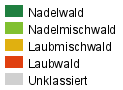
Within the project "Forest differentiation using digital satellite images", the FSO produced in 1996 two datasets covering the whole of Switzerland based on Landsat-TM satellite images. These two datasets cover the whole of Switzerland and divide the forest into the categories coniferous forest, predominantly coniferous forest, predominantly deciduous forest and deciduous forest.
This project has supplemented the Land Use Statistics for Switzerland with statistically reliable and geographically differentiated data on coniferous, deciduous and mixed forests. After geometric and radiometric correction of the satellite images, they were interpreted in two stages: the forest areas were separated from the non-forest areas and then divided into four degrees of mixedness.


Contact
Federal statistical office Section GeoinformationEspace de l'Europe 10
CH-2010 Neuchâtel
Switzerland
- Tel
- +41 58 463 68 35
Monday to Friday
09.00–11.30 and 14.00–16.00