
On the basis of data from the population and building and dwellings registers, the new population census system provides since 2010 diverse statistical information on buildings, dwellings, households and persons. Selected characteristics from the extensive data stock are analysed at hectare resolution and transformed into geodata, which is then made available.
In GEOSTAT's standard range of data based on the Buildings and Dwellings Statistics (BDS) some 140 building and dwelling variables aggregated by hectare are available.
Geodata production
Hectare reference
Building coordinates and the federal building identification number (EGID) are some of the characteristics listed in the federal building and dwellings register (BDR). This means that results from the buildings and dwellings statistics (BDS) can be analysed and visualised in high spatial detail for the whole of Switzerland.
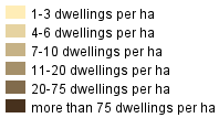
For the dissemination of data, statistical information on buildings and dwellings is analysed by using a hectare grid. For each hectare, the coordinates of the south-west corner (bottom left) are used as an identifier. Every characteristic or numeric value shown for each cell relates to occurrences within the 100x100 m surface of this cell, i.e. the number of buildings, for example, whose central coordinates are found in the square in question. In this way they build an aggregation of the individual records from a survey that are allocated to each grid cell or hectare.


Contact
Federal statistical office Section GeoinformationEspace de l'Europe 10
CH-2010 Neuchâtel
Switzerland
- Tel
- +41 58 463 68 35
Monday to Friday
09.00–11.30 and 14.00–16.00